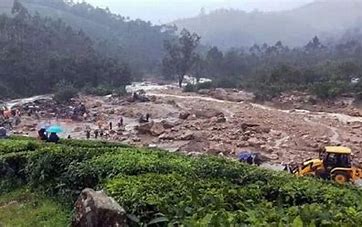
The catastrophic landslides that recently ravaged Wayanad in Kerala have brought to light the pressing necessity for a recalibrated approach to disaster risk management and environmental assessment protocols. In the aftermath of this tragic event, which resulted in the loss of more than 300 lives, left almost 300 individuals missing, and injured approximately 200, the extensive response and concerted efforts of both central and state authorities, along with national disaster response agencies, have been paramount. Yet, while the immediate relief efforts were the need of the hour, they reflect the urgent need for a more robust, scientifically driven approach to understanding and mitigating landslide risks.
The magnitude of the disaster has necessitated an intense, coordinated response from various agencies. The Indian Army, Navy, Air Force and National Disaster Response Force (NDRF) have played pivotal roles in the rescue operations. The Army’s medical teams have been at the forefront of providing emergency treatment to the injured, while specialised units from the Navy, Air Force and NDRF have been crucial in search and rescue operations, navigating the treacherous terrain to locate and assist those trapped. Concurrently, the Central Government, under the leadership of Prime Minister Narendra Modi, has sanctioned an ex-gratia payment of ₹2 lakh for the deceased’s families and ₹50,000 for the injured. Additionally, ₹145 crore has been allocated from the State Disaster Response Fund (SDRF) to the Kerala Government to facilitate ongoing relief operations. At the state level, Chief Minister Pinarayi Vijayan is managing disaster response efforts, overseeing coordination with central agencies and ensuring the provision of essential services to the affected regions.
The genesis of the Wayanad disaster was precipitated by a confluence of factors, including extreme meteorological conditions compounded by climate change. Scientists from the Cochin University of Science and Technology (CUSAT) have pointed to the warming of the Arabian Sea, which has led to the formation of intense cloud systems and exceedingly heavy rainfall within brief intervals. This climatic shift, combined with the region’s fragile terrain and significant loss of forest cover, created a perfect storm for the disaster. Rain gauge data reveals that the region experienced about 1830 mm of rainfall over the preceding 30 days, with a subsequent surge of intense precipitation acting as the final trigger for the landslides.
While the immediate response has been robust, the tragedy has highlighted significant gaps in our approach to landslide risk management. In the aftermath of the disaster, there has been considerable advocacy from various quarters for the implementation of the Gadgil Committee Report, officially known as the Western Ghats Ecology Expert Panel (WGEEP), which was commissioned by the UPA government in 2010, to address environmental concerns within the Western Ghats. However, while this report offers insights into environmental conservation, it does not adequately address the specific needs of Wayanad and analogous regions. The report, which primarily focused on the Western Ghats, used satellite imagery to analyse 8×8 kilometre large grids but did not conduct comprehensive ground-level research in Kerala. Though he is an expert on Maharashtra and Goa, it is worth mentioning that Madhav Gadgil has hardly done any groundwork in Kerala. The reliance on such broad analyses is not suited to address the specific geological and hydrological conditions that contribute to landslide susceptibility in different regions.
The limitations of the Gadgil Report are evident in the context of the recent disaster. Even if the recommendations of the Gadgil Report had been implemented, they would not have necessarily prevented the disaster. The landslides occurred in a forested area, far from quarries, other activities and land use changes primarily addressed by the report. The resultant devastation has impacted the downstream inhabitants. As such, its recommendations do not directly mitigate the risks posed by factors like intense rainfall and deforestation in specific areas like Wayanad.
A more refined approach is needed for effective landslide risk management. Current methodologies often rely on generalised assumptions, such as categorising any area with a slope greater than 20 degrees as high-risk. This broad categorization fails to consider the specific conditions that influence landslide susceptibility, such as soil stability, historical landslide occurrences, and localised rainfall patterns. The Landslide Atlas, released by ISRO, highlights Kerala as highly vulnerable, with Wayanad ranked 13th among the most landslide-prone districts, and requires a more detailed understanding of its landslide risks. What Kerala needs are better and more scientific surveys for setting up any classification to gain a detailed understanding of its landslide risks.
To address these challenges, a comprehensive strategy should be developed, incorporating detailed mapping of landslide-prone areas. This mapping should take into account localised data on soil conditions, slope angles, and rainfall thresholds and should be based on detailed geological and hydrological surveys rather than broad assumptions. Establishing precise rainfall thresholds for landslide-prone areas would allow for better forecasting and preparation. Implementing mini weather monitoring stations to track real-time rainfall and soil saturation levels would provide valuable data for predicting landslide risks and issuing timely warnings to communities at risk.
The establishment of effective landslide warning systems is also essential. These systems should be capable of detecting early signs of potential landslides and alerting local populations in a timely manner. Ensuring that these warnings reach those at risk and enabling them to take necessary precautions is crucial for mitigating the impacts of future landslides.
Moreover, community engagement and preparedness play a critical role in disaster management. Rather than suggesting impractical solutions like relocating the whole high-risk population away from their homes, efforts should focus on enhancing community awareness and resilience to landslide risks. Engaging with local communities to develop and implement preparedness plans can help reduce the impact of future landslides.
Developing an approach of integrated disaster management strategy that combines early warning systems, community preparedness, and sustainable land management practices will go a long way in combating such calamities in the future. This approach should be supported by regular updates to landslide susceptibility maps and the incorporation of local knowledge and experiences rather than broad classifications.
The role of the defence forces, volunteer organisations and NDRF in Wayanad reminds us of the importance of a well-coordinated disaster response. Their prompt and efficient actions in rescuing trapped individuals, administering medical care, and conducting relief operations serve as a clarion call for sustained investment in disaster preparedness and response capabilities. The central and state governments’ response, including financial support and coordination of rescue efforts, has been crucial in addressing the immediate needs of affected communities. The lessons from Wayanad must prompt a reevaluation of current practices and the adoption of targeted, evidence-based strategies to mitigate the impacts of such disasters in the future.
Yadul Krishna is an economist, policy commentator and the Parliamentary Secretary to a Member of Parliament from Kerala. X: @yadul_krishna


