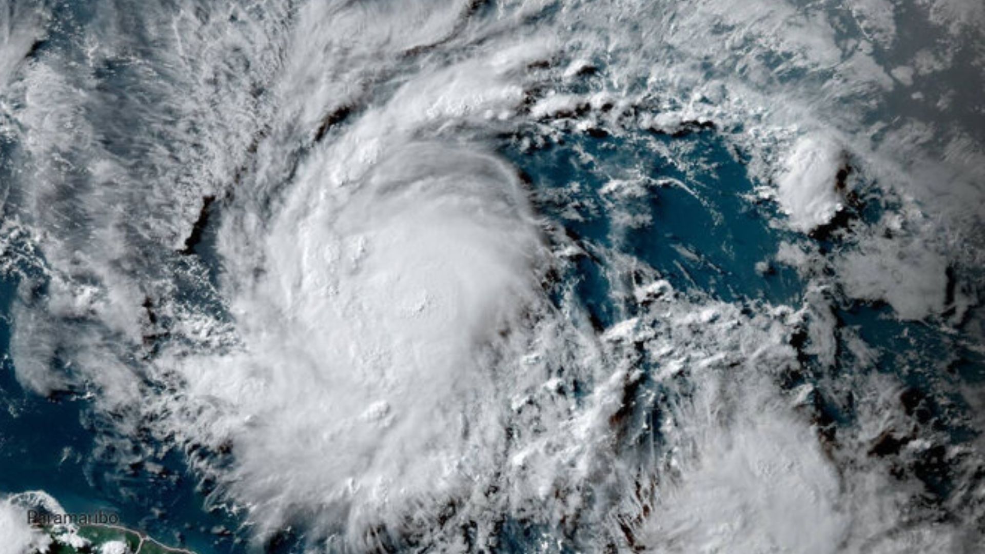
The first hurricane of the 2024 Atlantic season, intensified to a Category 4 hurricane on Sunday morning, with maximum sustained winds reaching 130 mph. This historic storm, the first-ever Category 4 hurricane recorded in June, was heading towards the Windward Islands.
The Windward Islands were expected to experience tropical storm-force winds by late Sunday or early Monday. It was uncommon for the season’s first storm to arrive so early, with the average first hurricane date being August 11. As of 11 a.m. ET, Beryl was located approximately 355 miles east-southeast of Barbados, moving westward.
The National Hurricane Center (NHC) issued warnings about potentially life-threatening storm surges, predicting water levels could rise six to nine feet above normal tidal levels near the eye’s landfall. This surge could create large, destructive waves along the coast. The hurricane had rapidly intensified, with wind speeds increasing by 55 mph in the 24 hours leading up to Sunday morning. Rapid intensification, as defined by the NHC, is a 24-hour increase in maximum sustained wind speed of 35 mph or more.
Mike Brennan, Director of the National Hurricane Center at NOAA, confirmed the rapid strengthening of Beryl. He stated that Beryl was expected to become a powerful hurricane before nearing Barbados and the Windward Islands. It was likely to remain strong as it moved into the eastern and central Caribbean early the next week.
Residents in areas with hurricane warnings were urged to prepare for significant storm impacts, including heavy rainfall, destructive hurricane-force winds, and dangerous storm surge and waves. Rainfall totals of 3 to 6 inches could lead to localized flooding across the Windward Islands on Sunday night and Monday. Hurricane warnings were in effect for Barbados, Saint Lucia, Saint Vincent and the Grenadines, Grenada, and Tobago.
Beryl’s rapid intensification was unusual for this early in the season, making it the Atlantic’s first major storm in 58 years. Tropical systems rarely form in June in the central Atlantic, east of the Lesser Antilles. According to NOAA records, only a few powerful systems have done so. Beryl was the third-earliest major storm in Atlantic history, following Hurricanes Audrey on June 27, 1957, and Alma on June 8, 1996.


