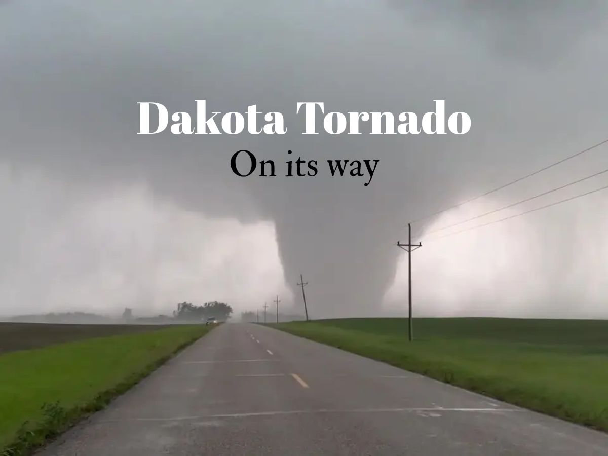
The National Weather Service issued urgent warnings after a strong tornado made landfall on Sunday afternoon close to Cannon Ball, North Dakota. A multi-vortex tornado in northern Emmons County was confirmed by weather officials, indicating an extremely powerful and erratic storm.
What Areas Are Under the Most Immediate Threat?
Active tornado warnings are in effect for specific counties in the path of the severe storm system. The NWS has issued its most urgent alerts for:
- Southeast Morton County
- Emmons County
- Sioux County
These warnings, urging residents to take immediate life-saving action, are initially in effect until 2:45 PM local time on Monday. East-central Sioux County and southwest Emmons County were specifically highlighted as areas under active warning as the storm progressed.
The NWS has also issued a broader Tornado Watch for a vast area of central North Dakota. This watch, covering 31 counties including Burleigh, Morton, McLean, Ward, Benson, and Barnes, is in effect until 9:00 PM Monday.
Tornado Watch: Means conditions are favorable for tornadoes to develop. People who live in a watch area should keep an eye on local news and be ready.
Tornado Warning: Indicates that radar has detected or detected a tornado. Residents in a warning area must take cover immediately.
What Should Residents in the Path of the Storm Do?
The National Weather Service and local emergency management officials are issuing critical guidance for safety. Residents in the warned areas are advised to:
- Move to a basement or a designated storm shelter immediately.
- If underground shelter is not available, go to an interior room on the lowest floor of a sturdy building, such as a bathroom or closet.
- Get away from windows and protect yourself from flying debris.
- Use your arms to protect your head and neck.
Also Read: Algeria’s Tebboune Appoints New PM and Energy Minister in Strategic Cabinet Reshuffle
What is a Multi-Vortex Tornado?
The confirmation of a multi-vortex tornado adds a layer of danger. This kind of tornado has several little whirls, or vortices, circling inside the main funnel. These vortices can cause additional, concentrated paths of extreme damage, making the storm even more unpredictable and destructive.
The storm system is being closely watched by officials as it sweeps across the area.
This is a developing story, Updates may follow.