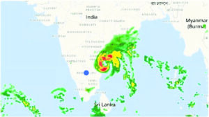
Tropical Cyclone Michaung made landfall along the Andhra Pradesh coast, specifically in Bapatla district between Nellore and Machilipatnam, on Tuesday, December 5, according to the India Meteorological Department (IMD) announcement on Monday evening, December 4. The storm, situated approximately 80 km southeast of Nellore and 120 km north-northeast of Chennai by 5:30 pm on Monday, was moving northward along the Andhra Pradesh coast. Its impact included heavy rainfall in Tamil Nadu, parts of Andhra Pradesh, and southern Odisha.
This cyclone occurrence in December is considered atypical due to the usual absence of storms with high intensity during this period. The IMD initially anticipated Michaung to remain a ‘tropical cyclone’ upon crossing the Andhra Pradesh coast but elevated its status to that of a ‘severe’ storm on Sunday, exhibiting wind speeds ranging from 88 kph to 166 kph. IMD experts highlighted the distinctive nature of such intensification during December, attributing it to the unusually high heat index off the southern Andhra Pradesh coast.
The Indian tropical storm season typically witnesses around five cyclones in the North Indian Ocean basin annually, with the Bay of Bengal experiencing approximately four and the Arabian Sea hosting one. Although fewer in number, Arabian Sea cyclones tend to reach higher intensities and pose greater threats in terms of widespread damage.
The Bay of Bengal and the Arabian Sea are most susceptible to cyclone formation during the pre-monsoon (April-June) and post-monsoon (October-December) periods, with storms in May and November often attaining higher intensities due to favorable oceanic conditions.
Tropical cyclones thrive on warm ocean temperatures, typically above 26 degrees Celsius at specific depths, aiding their rapid intensification while at sea.
The Tropical Cyclone Heat Potential (TCHP) serves as a crucial parameter influencing cyclone genesis, intensification, and propagation. Additionally, storm intensification involves a complex interplay of multiple atmospheric conditions like boundary layers, wind shear, convection, Rossby waves, upper ocean circulation, and air-sea interaction.
Post landfall, the IMD issued warnings of heavy to extremely heavy rainfall over various districts in Andhra Pradesh, potentially causing significant damage to standing crops like paddy and pineapples. Storm surges, tidal waves, and strong winds are anticipated during the cyclone’s approach, posing risks of inundation and flash floods in low-lying areas along the coast. The system is expected to progress northwestward towards southern Odisha, prompting an ‘orange’ alert from the IMD.
Amid days of waterlogging in the state, the patience of the people of Chennai has broken as many residents of different areas complain of shortage of even drinking water and lack of cleanliness. In the Pattalam area in Chennai, roads are still waterlogged and the people are complaining of a lack of cleanliness and absence of necessities.
- 24 hours Outlook for the Flash Flood Risk (FFR) till 11:30 IST of 06-12-2023:
- High flash flood risk likely over few watersheds & neighbourhoods of following coastal districts of Andhra Pradesh
- Guntur, Prakasam and Krishna (>50%) districts of Andhra Pradesh;
- Moderate flash flood risk likely over few watersheds & neighbourhoods of following coastal districts (>20% – <50%) of Andhra Pradesh and Telangana during next 24 hours.
- West Godavari, Guntur, Kurnool, Prakasam and Nellore (>20%<50%) districts of Andhra Pradesh; Nalgonda, Suryapet, Khammam, Bharadri kothagudem and Mahabubabad (>20% Telangana. – <50%) districts of Telangana.
- Surface runoff Inundation may occur at some fully saturated watersheds & low-lying areas over AC as depicted in map due to Severe Cyclonic Storm “Michaung during next 24 hours.


