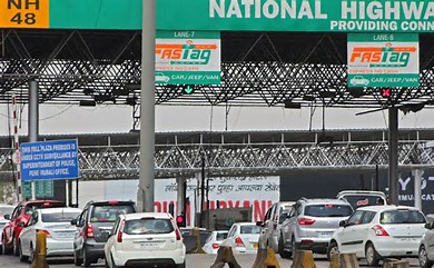
The Ministry of Road, Transport, and Highways has introduced revisions to the National Highways Fee Rules, incorporating a GPS-based toll collection system. This new system will use satellite technology for toll payments, reducing the need for toll plazas and easing traffic on highways.
What is GPS-Based Toll Collection?
Currently, tolls are paid manually or through FASTag, which can still cause traffic congestion. The new GPS-based system uses satellites and in-car tracking devices to calculate tolls based on the distance travelled. This system relies on GPS technology to track vehicle movement and determine charges accordingly.
How Does it Work?
Vehicles equipped with On-Board Units (OBUs) or tracking devices will share their coordinates with satellites. These coordinates will be used to calculate the distance a vehicle covers on highways, and tolls will be charged based on that distance. Initially, this system will be rolled out on major highways and expressways, and users will be able to access it via government portals, similar to FASTag.
How is it Different from FASTag?
Unlike FASTag, which uses RFID technology for toll payments, the GPS-based toll system leverages Global Navigation Satellite System (GNSS) technology for precise location tracking, offering a more efficient toll collection method.
Benefits of the GPS-Based System:
– No More Traffic Jams: The system eliminates the need for toll plazas, reducing long queues and easing traffic flow.
– Distance-Based Charging: Vehicles will be charged based on the actual distance they travel on highways, making the system more accurate.
– Nationwide Rollout: The system will first be implemented on key highways and expressways before expanding further.


