International trade relies so much on sea transport efficiency and security of these movements rest on accurate and timely ocean predictions. They are not weather forecasts they are lifelines for vessels traveling across temperamental seas.
By monitoring satellite and sea data meteorologists can pinpoint and alert of oncoming storms, high seas and strong currents that can represent threats to shipping lanes. The newest technologies upgrading this functionality is Sentinel-6B, a satellite to be launched this November which will make crucial observations of sea level rise, wind speed and ocean turbulence.
What is Sentinel-6B?
Sentinel-6B is an evolution of a decades long global cooperation among NASA, ESA, NOAA and other space agencies. It is designed to follow up the work of its identical twin Sentinel-6 Michael Freilich that was launched in 2020. Both carry radar altimeters on board to measure changes in sea surface height with great precision.
ALSO READ: NASA’s Northrop Grumman CRS-23 & SpaceX Falcon 9 Launches | Watch Live Event
They form part of the Sentinel-6/Jason-CS mission that has been monitoring Earth’s ocean dynamics continuously since the 1990s. The information derived is not merely used in weather forecasting but to chart vast ocean circulation such as the Gulf Stream which can turn suddenly and devastatingly impact ships at sea.
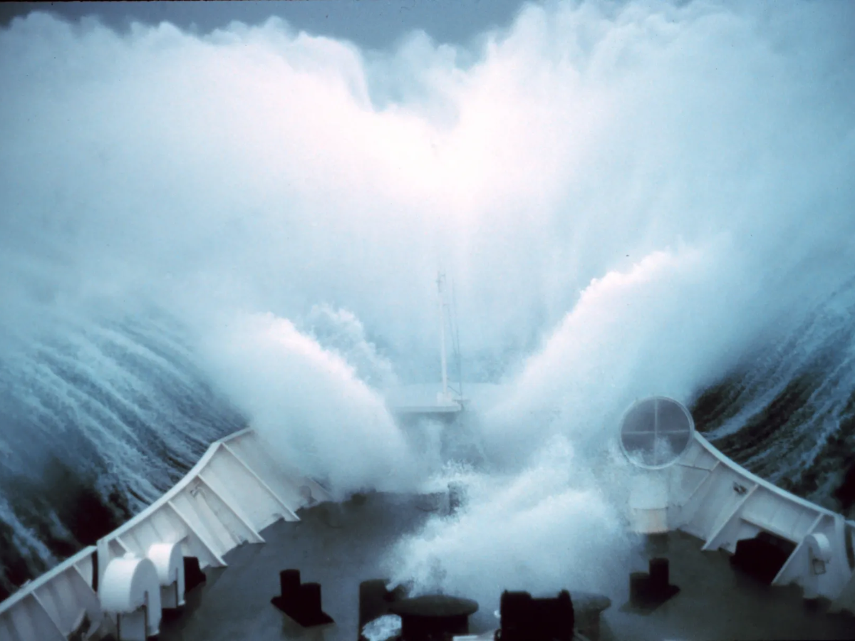
When Currents Collide with Consequences?
The most perilous ocean scenario is when major currents collide with wave patterns. The Gulf Stream has dramatic temperature and elevation gradients. Warm water floats on top due to thermal expansion and when strong wave patterns move over these regions with things can quickly go wrong in a hurry. Despite looking peaceful skies overhead container ships have been shipwrecked or lost their loads due to such silent interactions.
ALSO READ: Rare Blue-Hued Blood Moon Spotted During Total Lunar Eclipse, NASA Releases Photos
Satellite altimetry is the only truly comprehensive means of tracking these complex changes across big areas something that wayward ocean sensors simply can’t achieve due to the patchy coverage.
What is Preserving Data Constancy Over Decades?
The Sentinel-6B will play a key role in maintaining over three decades of sea level observations. It is by replicating the identical orbit of previous mission which ensures data consistency and calibration accuracy providing an uninterrupted and continuous timescale of sea-level trends.
The long-term dataset serves as a benchmark for oceanography research with a template for monitoring how our oceans are evolving in a rapidly warming world.
ALSO READ: How Were Black Holes Discovered: 240 Year Journey from Dark Stars to Reality