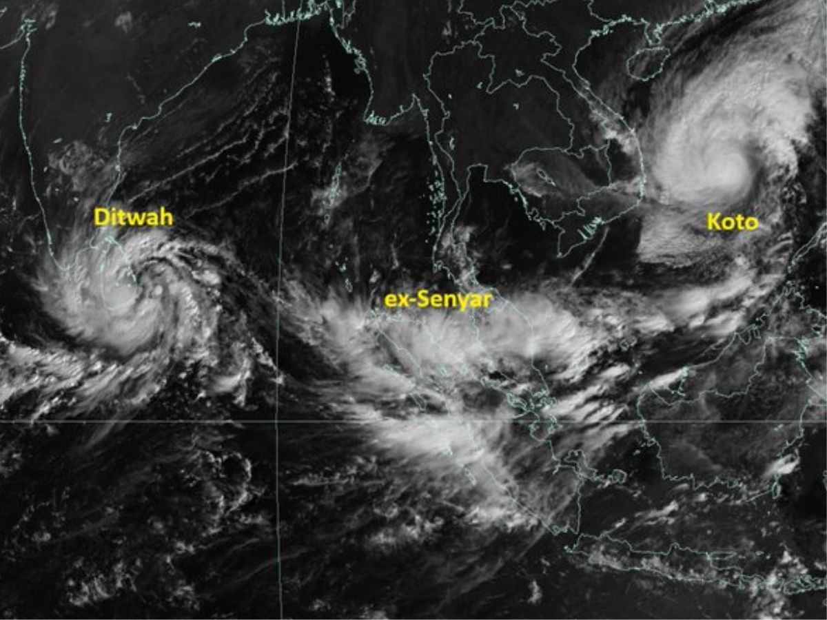
A new cyclonic system has formed over the southwest Bay of Bengal even as Cyclone Senyar, which developed in the Strait of Malacca, moved away from India. According to the India Meteorological Department (IMD), the fresh system has now strengthened into a cyclonic storm and is likely to make landfall along the Tamil Nadu, Puducherry, and adjoining south Andhra Pradesh coast by November 30.
Cyclone Senyar Weakens in the Andaman Sea
In the early hours of Thursday, IMD reported that Cyclone Senyar was located about 850 km southeast of Car Nicobar, the northernmost part of the Nicobar Islands. The storm continued to drift away from India and was expected to weaken into a depression by evening.
This rare storm emerged in the Strait of Malacca, the narrow waterway between Peninsular Malaysia and the Indonesian island of Sumatra. Malaysia’s weather authorities noted that the cyclone was moving toward western Malaysia and near Sumatra.
MetMalaysia director-general Mohd Hisham Mohd Anip said such a system is unprecedented in the region.
He explained: “The last one, a tropical depression, occurred in 2017 and affected Penang. But for a system to reach tropical storm intensity, as we are now seeing near Sumatra, this is a first.”
The storm is expected to bring heavy rain, strong winds, and dangerous sea conditions to northern Malaysia. Many weather experts have called it a “rarest of rare” event, with some noting that it may become the first recorded tropical cyclone to hit Malaysia’s west coast.
Cyclone Ditwah formed over the SW Bay of Bengal near 6.9°N/81.9°E at 1130 IST today. It lay close to Pottuvil, ~90 km SSE of Batticaloa and ~700 km SSE of Chennai. The system will move NNW and reach off North Tamil Nadu–Puducherry–south AP coasts by early 30 Nov. pic.twitter.com/I8sQbCqbk7
— India Meteorological Department (@Indiametdept) November 27, 2025
Cyclone Ditwah Forms Over Bay of Bengal
Meanwhile, another weather disturbance over the southwest Bay of Bengal and nearby parts of southeast Sri Lanka has intensified into a cyclonic storm. IMD announced that the storm has been named Cyclone Ditwah, a name suggested by Yemen under the official cyclone naming list for the north Indian Ocean.
In a post on X, the IMD wrote, “Cyclone Ditwah formed over the SW Bay of Bengal near 6.9°N/81.9°E at 1130 IST today. It lay close to Pottuvil, ~90 km SSE of Batticaloa and ~700 km SSE of Chennai. The system will move NNW and reach off North Tamil Nadu–Puducherry–south AP coasts by early 30 Nov.”
The storm is expected to move in a north-northwest direction and approach the coastline by early November 30. As a precaution, the IMD has issued yellow and orange alerts for several Tamil Nadu districts including Chennai, Nagapattinam, Thiruvallur, and Thanjavur for November 27, 28, and 29.
A Rare Weather Event in the Malacca Strait
Cyclone Senyar has drawn international attention because of its unusual formation. The Strait of Malacca has almost never seen a storm intensify to cyclonic strength. Weather experts say the region’s geography and typical wind patterns make such development extremely uncommon.
Also Read: What is Cyclone Ditwah? All You Need to Know About the Next Storm in the North Indian Ocean


