Cyclone Senyar, currently over northeast Indonesia, is weakening into a deep depression. Meanwhile, a new weather system over the Bay of Bengal threatens heavy rainfall across Tamil Nadu, Puducherry, Kerala, and Andhra Pradesh. Authorities have issued alerts as southern states prepare for possible flooding.
Senyar Weakens Over Southeast Asia
The India Meteorological Department (IMD) reported that Cyclone Senyar moved southeast at 10 kmph over the past six hours. As of 11:30 pm on November 26, it was near latitude 4.0° North and longitude 98.5° East, roughly 200 km southeast of Kuta Makmur in Indonesia and 250 km southwest of George Town, Malaysia.
“The storm is likely to continue moving southeast and weaken into a deep depression by the morning of November 27,” IMD officials said. It is expected to turn eastward and further weaken into a depression by afternoon or evening. Meteorologists noted that such recurving behaviour is normal in the Strait of Malacca.
Authorities have advised ships and fishermen to stay away from the Strait of Malacca, the South Andaman Sea, and waters near Thailand, Malaysia, and Indonesia until the storm passes.
New Bay of Bengal System Threatens Southern States
While Senyar weakens, a well-marked low-pressure area over the southwest Bay of Bengal intensified into a depression late Wednesday night. As of 11:30 pm on November 26, it was centred near latitude 5.9° North and longitude 82.6° East, about 170 km east of Hambantota and 210 km south-southeast of Batticaloa in Sri Lanka.
The system is expected to move north-northwest across the southwest Bay of Bengal and Sri Lankan coast, strengthening into a deep depression within 12 hours. IMD officials warned that it will likely approach North Tamil Nadu, Puducherry, and southern Andhra Pradesh over the next 48 hours.
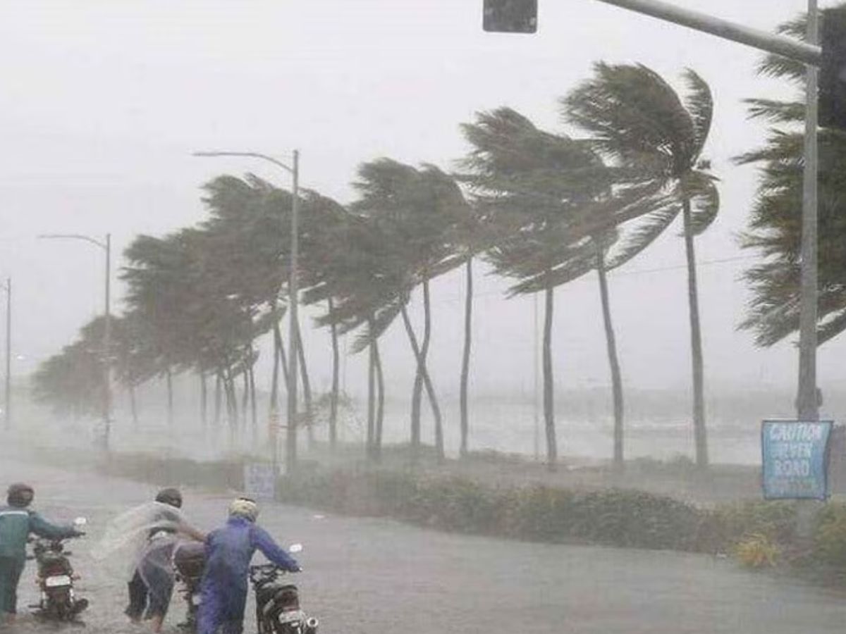
Heavy rainfall is forecast across Tamil Nadu, Puducherry, Kerala, Andhra Pradesh, and the Andaman & Nicobar Islands. “Residents and authorities should stay alert for flash floods and waterlogging in low-lying areas,” meteorologists advised.
Impact on Tamil Nadu and the Nicobar Islands
Tamil Nadu has already experienced flooding in Kanyakumari, Tirunelveli, Thoothukudi, Ramanathapuram, and Nagapattinam due to heavy rains on Monday and Tuesday. Dense cloud cover and strong winds are expected to continue as the new system approaches.
The Nicobar Islands, being closer to Senyar’s path, may feel the storm first. Officials have urged residents to avoid coastal areas and follow safety instructions issued by local authorities.
Fishermen have been specifically warned to avoid venturing into the sea, and local administrations are coordinating with disaster management teams to ensure timely evacuations if necessary.
Dual Systems Challenge Disaster Response
The simultaneous presence of Cyclone Senyar weakening over Indonesia and a new depression forming over the Bay of Bengal poses a rare challenge for disaster management.
Authorities need to monitor both systems closely to prevent confusion and ensure preparedness in coastal and flood-prone regions. Experts say this dual threat underscores the need for enhanced early-warning systems and better coordination between states and maritime authorities.