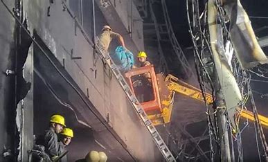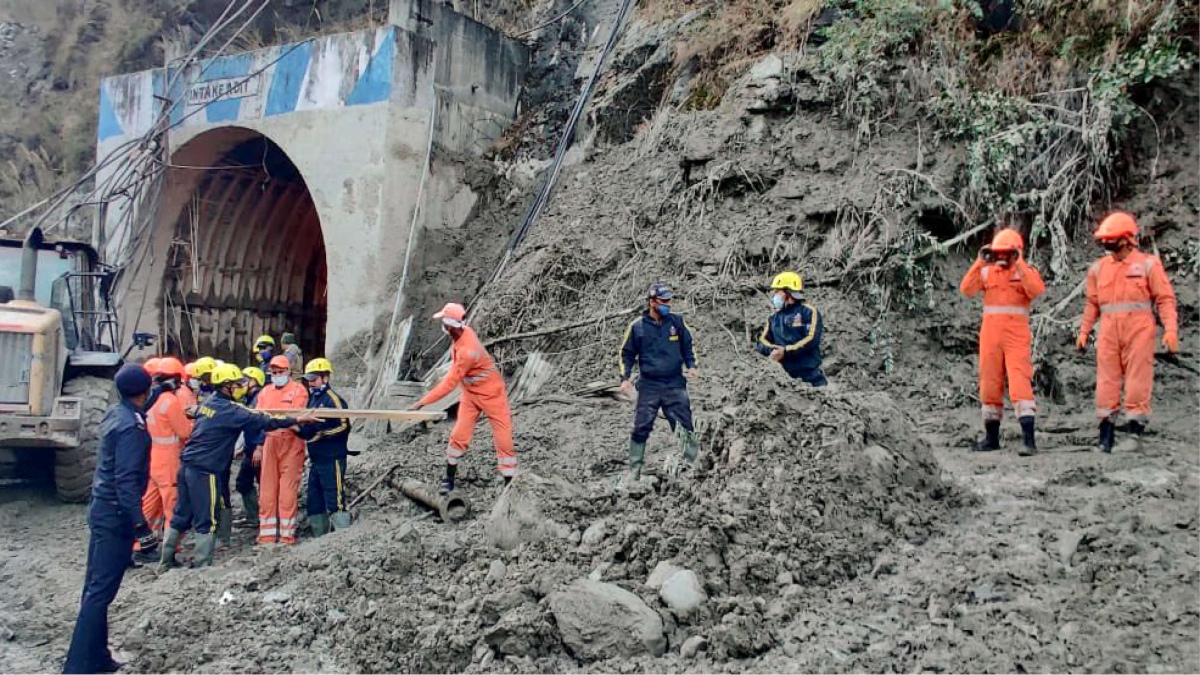
The recent Uttarakhand disaster, a tragedy of a high magnitude, causing massive losses and damages to the state and its citizens, has become another victim of spin doctoring. The media as well as decision makers are diverting attention from institutional and procedural deficits towards a daring, nail-biting rescue operation by the uniformed men of ITBP, who are seen attending to the nation’s call for duty as they wade through deadly, freezing knee-deep water and slush, pulling in the little available oxygen inside a deep tunnel. It’s an operation where those rescued alive display a success story and the dead are mere numbers. People are also being shown the Centre’s heartfelt assurance to the state government for providing all possible assistance in continuing the relief and rescue operation. We unquestioningly absorb what we see in the media: the unmatched efficiency of all agencies and organisations, their scintillatingly extraordinary work and how the government stands in close coordination with the affected persons at ground zero. Why an argument on disaster accountability should be abandoned at such an hour is not a matter of debate anymore as it is not the right time to redress the vagary of the tormentor, nonetheless a portrayal of a vigilant as a political outcaste!
Yet, it is unavoidable to recast the offense of a glacier as human accountability. Was this tragedy caused by the recklessness of a glacier or a tempestuous river, the Dhauli Ganga in this case? Were they labelled as offenders notwithstanding a veiled human arrogance becoming the final barrier to understanding disasters? Interestingly, disaster mitigation is uniformly engaged in ‘rescue and relief’ operations despite it being an aberration of the Hyogo Declaration of 2005, which turns upside down even the Sendai Framework of 2015, where ample research anchored it in ‘preparedness’. The red herrings by the media delay, distract and implant a smokescreen so effectively that a lot of time is wasted in circumventing the logic that raised not one but 14 dams, besides the five under construction, in the fragile and delicate ecological terrain of Uttarakhand. The Tehri Dam is the largest and tallest dam in India and the eighth highest dam in the world, and dams the ferocious Bhagirathi river at the sensitive point of its confluence with Bhilangana. Further, the Alaknanda’s turbulent flow is obstructed by not one but six operational hydroelectric projects, while eight more are under construction and may soon bring increased reservoir pressure on the eroded and fractured rocks of the unstable Himalayas. A total of more than 14 hydroelectric projects cut across the small state of Uttarakhand and many more are being constructed, yet the requirement of Environment Impact Analysis reports has been pursued more as a ritual than something of substance prior to their construction. These projects have been pushed without comprehensive bio-engineering and reservoir slope stability measures combined with downstream catchment area planning including construction bylaws. So, the offence is located neither with the glacier or with the river.
German meteorologist Alfred Wegener developed his Theory of Continental Drift in 1912 whereby giant tectonic plates drift away, collide and form mountains and water bodies over a period of many million years. The Himalayas are a result of the collision of the Indian and the Eurasian plates in which none of them could be subducted but in the process, their folding, faulting, breaking and thickening elevated it to a height of 8,848 metres which holds Mount Everest now, the highest point on Earth above sea level. This collision is still continuing and with the help of the modern technology of Global Positioning System (GPS), it has been found that the Indian plate is moving towards the north, which has been raising the Himalayas’ height by more than 1 cm per year. The rocks are splitting apart with deep crevices and subsequently glaciers are generating crevasses, making the whole region vulnerable to fragile and loose glaciers. The Himalayas would take a few hundred years more to settle down but this journey to stability may pass through unprecedented and highly impactful disasters in the region. No super science is needed to authenticate major risks in dam constructions over such unstable terrain unless cleared through a thorough and intensive environment impact analysis which segregates the assessment of geological, ecological and geo-morphological concerns. The argument used to justify dams has mostly been that people want electricity for development, but this development has become a cause for destruction. Disaster management authorities can prevent such hazards from turning into disasters through preemptive monitoring.
The local communities of Uttarakhand have been rarely delighted about any dam over the Ganges, which they hold in high honour and as a living sacred deity. They believe that the flow of the Ganges as it descended over the earth was so turbulent that it could have flooded the whole planet. Lord Shiva had to intervene to hold the Ganges in his matted locks and gradually release its water through seven streams which were named Bhagirathi, Janhvi, Bhilangna, Mandakini, Rishi Ganga, Saraswati and Alaknanda. Any obstruction in the free flow of these rivers through dams or otherwise is treated as a sacrilege by local people. These local hill and mountain communities never needed science to declare the occurrence of disasters in specific areas. M.L. Pant, the Chief Editor of Dainik Bhaskar, predicted the 2013 Uttarakhand disaster with a front-page report as early as 2003 simply because Kedarnath was his village and he was passionate about its safety. Yet, such local informers are castigated by the administration, police and district authorities and fines are imposed on their free speech. The portrayal of such whistle-blowers as potential threats to the nation’s progress and implants of foreign funding is a serious offence which overlooks a disaster in the making. Democracy and free speech are sine qua non of disaster management.
The Sunday morning flood had been preceded by two days of rain and snow, a situation in which water mostly gets trapped under glaciers. The Nanda Devi glacier could have created an underground lake with millions of cubic metres of water underneath. The Planet Labs with their 150 satellites have provided an unprecedented dataset of imagery from the earth’s observation and geospatial insights into disasters such as the one on the morning of February 7. It reveals a release of more than 2.3 million cubic metres of water caused by the avalanche. This magnitude of disaster-destroyed infrastructure downstream washed away at least seven bridges and cut off people from about 11 villages. At least four power projects have been also completely damaged for the second time after the 2016 floods. These are, the Tapovan Vishnugad (NTPC), Pipalkoti (THDC India), Vishnuprayag (Jaypee Group) and the Rishi Ganga (Kundan Group). A tentative preliminary assessment of damages and losses of all infrastructure taken together would exceed Rs 24,000 crore by putting the basic cost of one project at around Rs 3000 crore which is the initial minimum cost for the Tapovan project. The disaster management authorities could have worked closely with the datasets on these dams from Planet Labs, especially when the weather alerted a hazard.
The privately managed Rishi Ganga project and the NTPC’s Tapovan projects have been victims of either a glacial lake outburst floods (GLOF), a cloudburst, an avalanche or glacier calving. It could have been any or all of these as the terrain is hazard-prone and not fit to hold such projects or ones which drill through and construct long tunnels such as the 2 km-long tunnel at the Tapovan hydel project in Chamoli or even forest clearing for excessive constructions in the catchment areas. Many villagers who were caught unaware at the Raini village, the first strike area, reported elderly people missing in floods since there was less time to evacuate them in the face of the advancing turbulent slush floods. The Rishi Ganga project and many motorable bridges were washed away. No one knows the number of clueless animals washed away who were out in the sun after two days of rain on a Sunday morning. The domesticated animals alongside the human shy wildlife have never been given their due by EIA teams, mostly controlled by scientists, which prevents them from taking a wider and more holistic view of the impact of disasters. It is ironical that this aspect was missed out even in the robust and rigorous set of the NDMA Guidelines for Management of Glacial Lake Outburst Floods (GLOFs) for preventing such disasters. Most of the suggested monitoring through human teams, drones, unmanned aerial vehicles and early warning systems could not pick-up speed.
Every disaster stirs our conscience to go beyond a call for duty to prevent many avoidable disasters through advance planning. There is a need to reclaim the Sendai spirit and not go backwards to pre-Hyogo meandering around rescue and relief operations. It’s time to invest in preparedness more sincerely and generously and harness the power of community in village panchayats, schools and in every home in or around a hazard-prone area. There is no alternative to making citizens partners in disaster risk assessment and identification.
The writer is a former professor, Founder Chairperson of the Special Centre for Disaster Research, JNU, and President, NAPSIPAG Disaster Research Group. The views expressed are personal.

